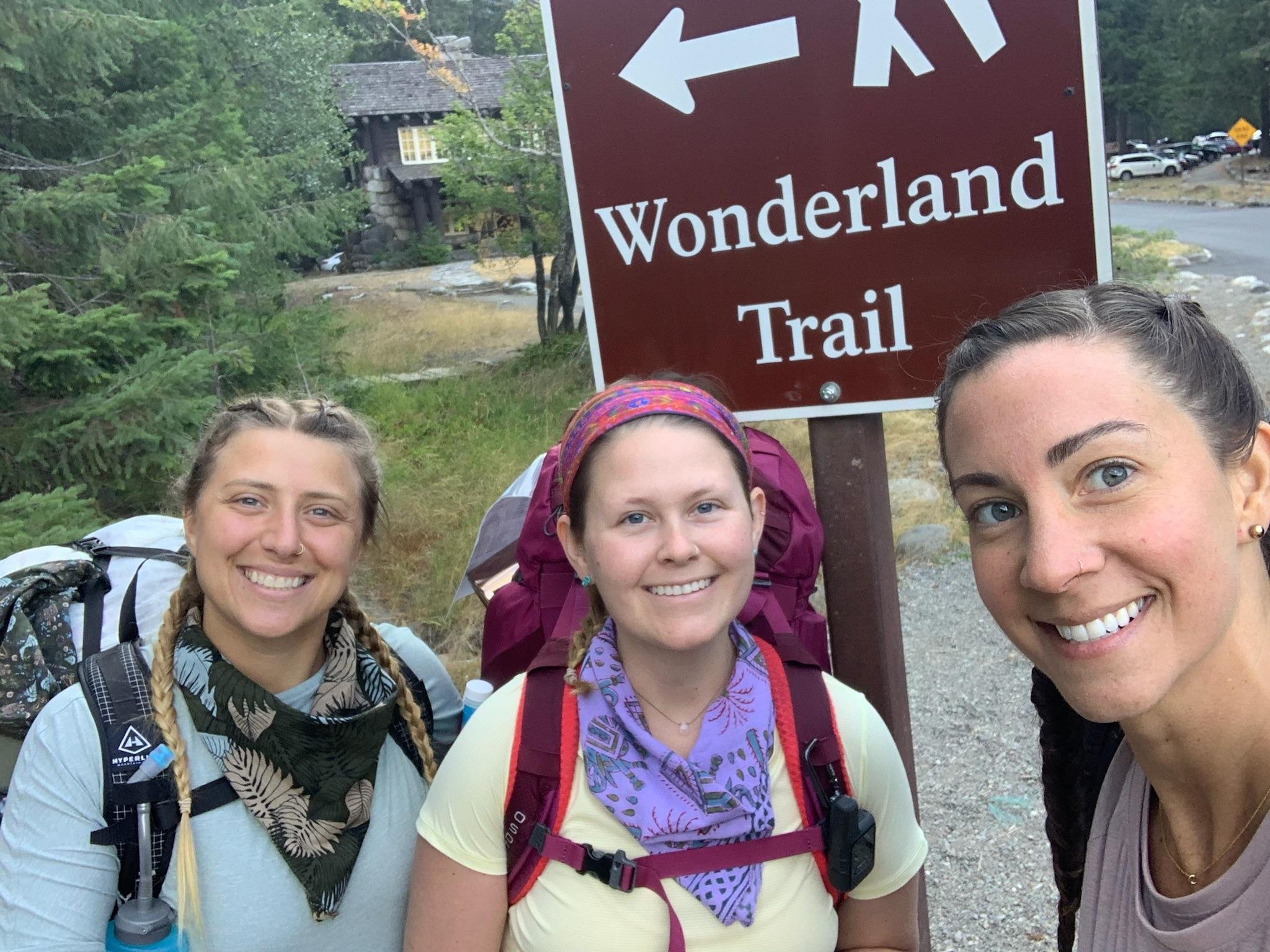
Backpacking the Wonderland Trail

All photos captured by Savanna Waites
About the Trail
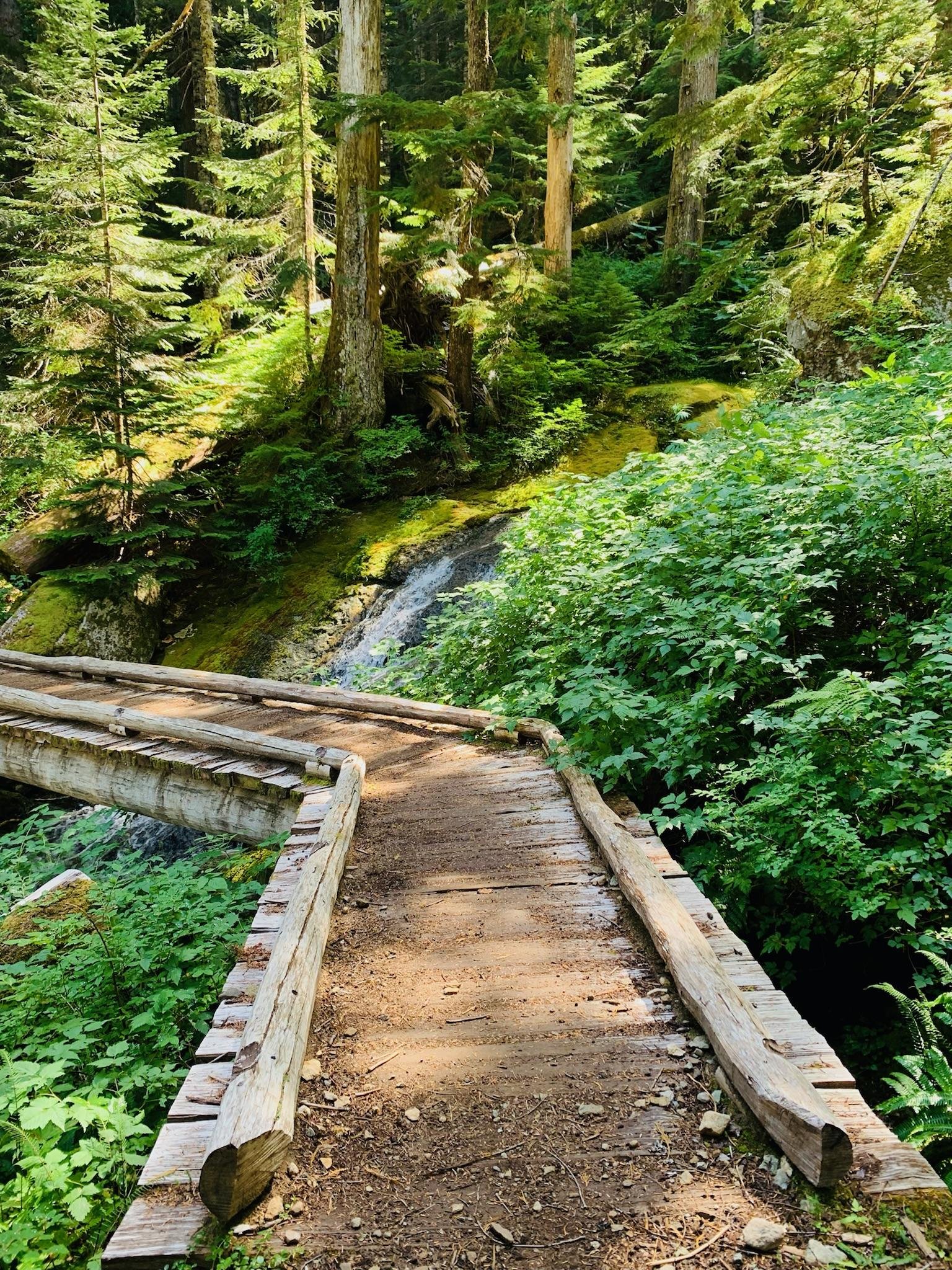
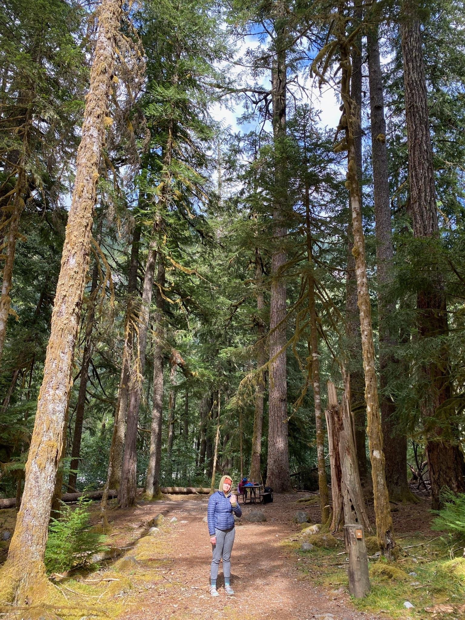
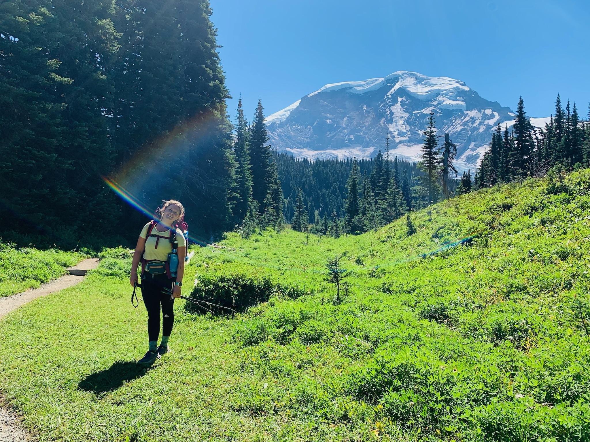
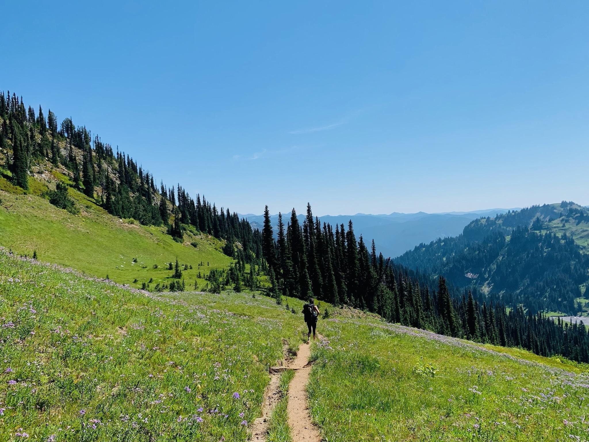
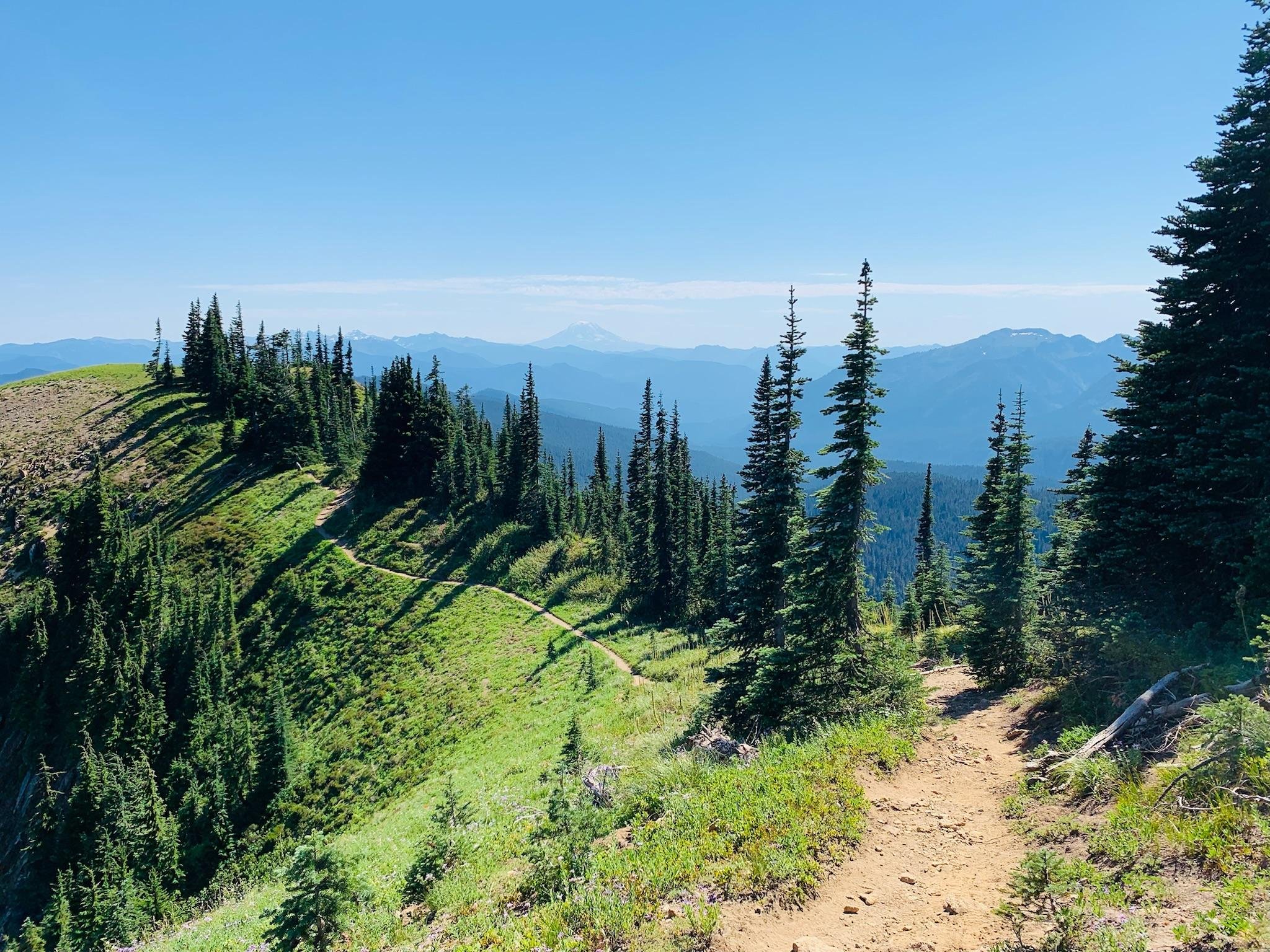
The Wonderland Trail is a 93 mile trail which circumnavigates the base of Mount Rainier, located in Mount Rainier National Park, in Washington state. The Wonderland Trail boasts 22,000 feet of elevation gain while traveling through valleys, forests, meadows, subalpine and high alpine areas. The average backpacking time on the trail is between 9 and 14 days, depending on the source. Timelines for backpacking the trail vary due to campsite permit availability, personal fitness level, and the speed at which you’d like to absorb Mount Rainier! We opted for 9 days, 8 nights which allowed for 800+ cumulative pictures, sleeping in, and making it to every campsite with plenty of time to set up our tent before dark. If you’re looking for an expedited journey around the mountain, it is possible to run the trail. The average thru-run of the Wonderland Trail takes about 3 days, and averages around 31 miles a day. The Fastest Known Time (FKT) stats for the trail (as of September 2022) include Male Supported: Tyler Green 16h 40m 55s, Male Unsupported: Ryan Montgomery 18h 49m 11s, Female Supported: Kaytlyn Gerbin 18h 41m 54s, Female Unsupported: Alex Borsuk 1d 0h 1m 26s. Talk about impressive!
Why I chose it
During grad school, I was a graduate assistant for the Campus Recreation facility. I’d spend my afternoons and evenings at the gym after work. During treadmill or stairmaster workouts, I’d watch YouTube videos of other people on adventures or running ultra marathons. One of the videos I watched was about the Wonderland Trail. I kept coming back to it and told myself I’d take on the trail one day, either running or backpacking. Even after grad school and a career change (or two), I found myself still dreaming of taking on the Wonderland Trail. While out for a couple of beers, some friends asked what big event was next for me. I told them my idea and asked if they’d join. Not sure if it was the beer or the Googled images of Mount Rainier, but they agreed to backpack it with me the following fall.
About the Planning & Permitting
I entered the early access lottery on February 24 2022. I was notified of being selected during the lottery on March 14, 2022. This provided me with a date of April 1, 2022 for early access campsite booking. This gave me two weeks to come up with an itinerary with my friends. Our goal was to accommodate everyone’s physical abilities when considering a total number of days, average daily mileage, maximum mileage on any given day. We settled on 8 nights, 9 days, and our longest day being just over 18 miles.
We made a list of ideal campsites along the trail in hopes we would be able to snag them when our lottery date arrived by using the online Wonderland Itinerary Planner by Wonderland Guides. This provided various campsite options with +/- mileage for alternate sites. One of the logistics to consider was if we should go clockwise or counterclock on the loop. Instinctively, we chose clockwise but not for any particular reason and without any research as to which would be “better”. While writing this I learned most travel the trail clockwise because it creates one less sustained climb and is labeled as the “traditional” route.
Books
As a birthday gift to one of the girls joining me, I sent her a book about the trail and a National Geographic map of Mount Rainier. Turns out, I’d also order those for myself and an additional book for good measure. The two books we referenced included “Hiking the Wonderland Trail: The Complete Guide to Mount Rainier's Premier Trail” by Tami Asars and “Plan & Go | Wonderland Trail” by Alison Newberry and Matt Sparapani. I highly recommend both of these books. I did find myself using Tami Asars’s book about the trail more and I feel like it provided me with the information I needed in preparation for this hike. Some of the main things we referenced the books for included food caches, water sources, and campsite information.
Food Caches
Rather than carrying all of our food for the trip, we opted to drop off food caches the day before we started our hike. There are a couple places along the trail to do this and optimal locations depend on which trailhead you start at. The Longmire trailhead was our entry and exit. The best food cache locations for us were Carbon River Ranger Station (Mowich Lake) and White River Ranger Station. This would allow us to carry three days worth of food, then pickup our resupply on nights 3 and 6.
We picked up our permit from the White River Ranger Station after doing last minute grocery shopping for our food caches. Important items included wine and sweet treats for our resupply days. When we arrived at the station, we were greeted by a ranger who informed us we could drop off our White River food cache with them but we wouldn’t be able to make it to the other ranger at the Carbon River Ranger Station before it closed for the day. This would mean we’d carry 6 days worth of food from Longmire to White River.
Luckily, the same ranger was also working the following day at the same station. The WR ranger gave a quick call to the Carbon River ranger and they suggested we meet at a grocery store just outside of the park to drop off our food cache! In an effort to protect the rangers who helped us, I did not include their names, just in case! We are forever grateful for the kindness and generosity they showed us. With this being said, arrive early to drop off your food caches and know that it is a 1.5 hour drive between the two ranger stations.
Permit Adjustment

When we first set up our permit online, we weren’t able to snag two of our preferred campsites for days seven and eight. This wasn’t an issue because we found two other sites down side trails from the Wonderland Trail. These two sites would give us the option to complete the Wonderland but add extra mileage. From our understanding, there could be an opportunity to adjust our permit when we picked it up. This is due to other groups changing their itinerary or canceling and walkup permit availability. Luckily, there were spots available at our ideal campsites and our permit was easily adjusted!
Park Entry Fee
In order to enter Mount Rainier National Park, there is a fee of $30 per car. This allows access to the park for 7 consecutive days. In our case, we would be in the park for 10 days total but only leaving and re-entering the park on our food cache/permit day. Once our car was in the park, we could leave it parked without an additional fee while we hiked the trail.
Getting to the trail
There are a couple entrances to the park but our start and finish was the Longmire Trailhead. We booked a sweet, little cabin just a few miles from the Longmire park entrance to make our first morning easier. This allowed us to spend only a short time in the car before stretching our legs, using the restroom, and starting our journey! The reason I mention this is because Stevens Canyon Road was closed to traffic for repairs. This required folks to find alternate routes between some of the park entrances which took more time, with a less direct path. I highly recommend checking online for park updates and closures before planning or beginning any trip. You can find this information on the National Parks Website under the specific park you are visiting.
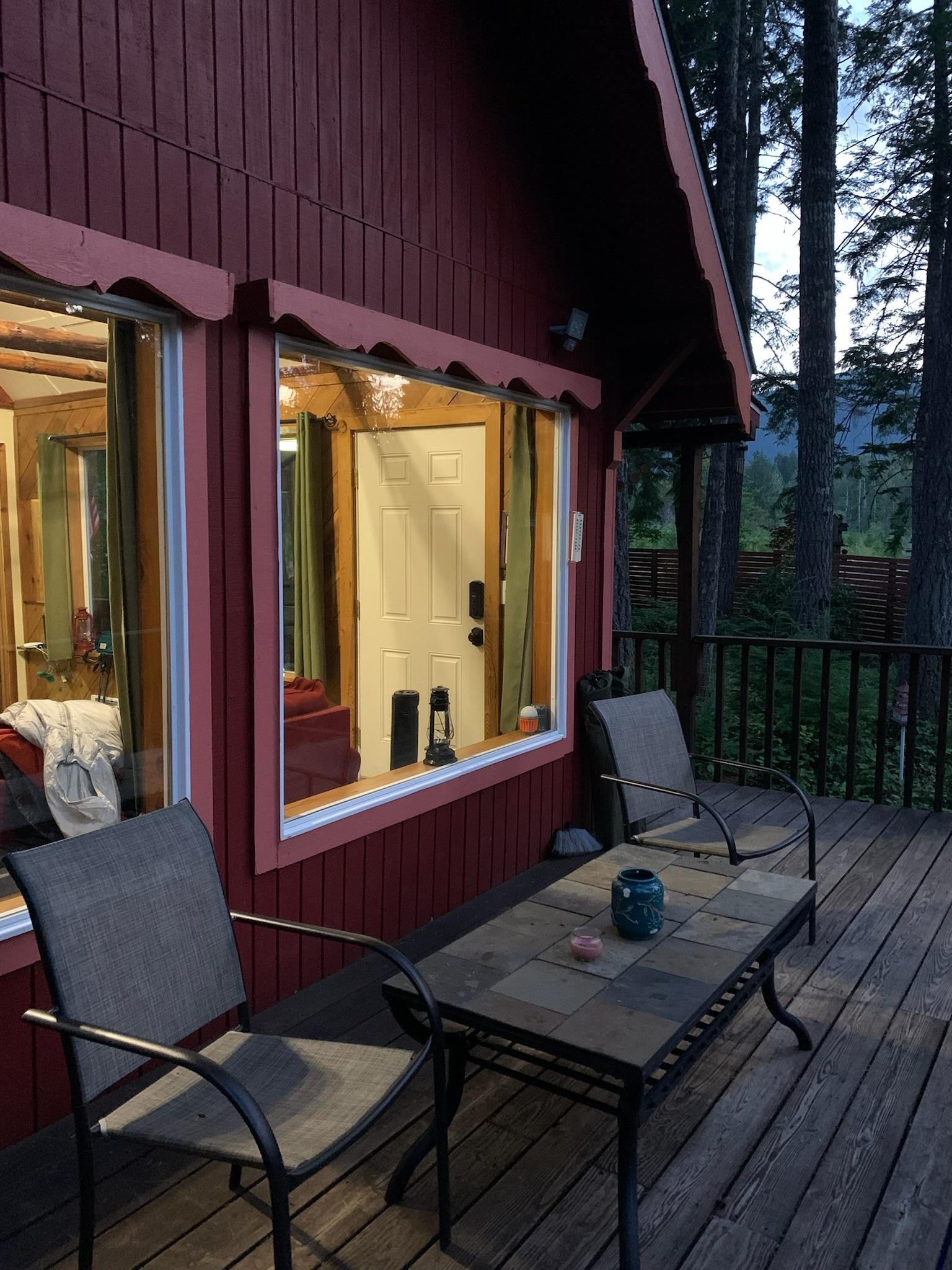
Below: cabin views just outside of Mount Rainier National Park
Weather and Trail Conditions

We had excellent luck with weather and trail conditions. The daytime was sunny and warm, the evening was cool and dry. The only exception to this was at Mowich Lake. That evening, at 5,000 ft, it decided to sprinkle on us after dinner. This seemed like perfect timing because we had already climbed into our tent for a few rounds of Uno and cans of wine. We even woke up to a salamander friend keeping warm between our ground tarp and tent.
Campsites and My Trail Journal Perspective
We stayed at the following camps along the Wonderland Trail:
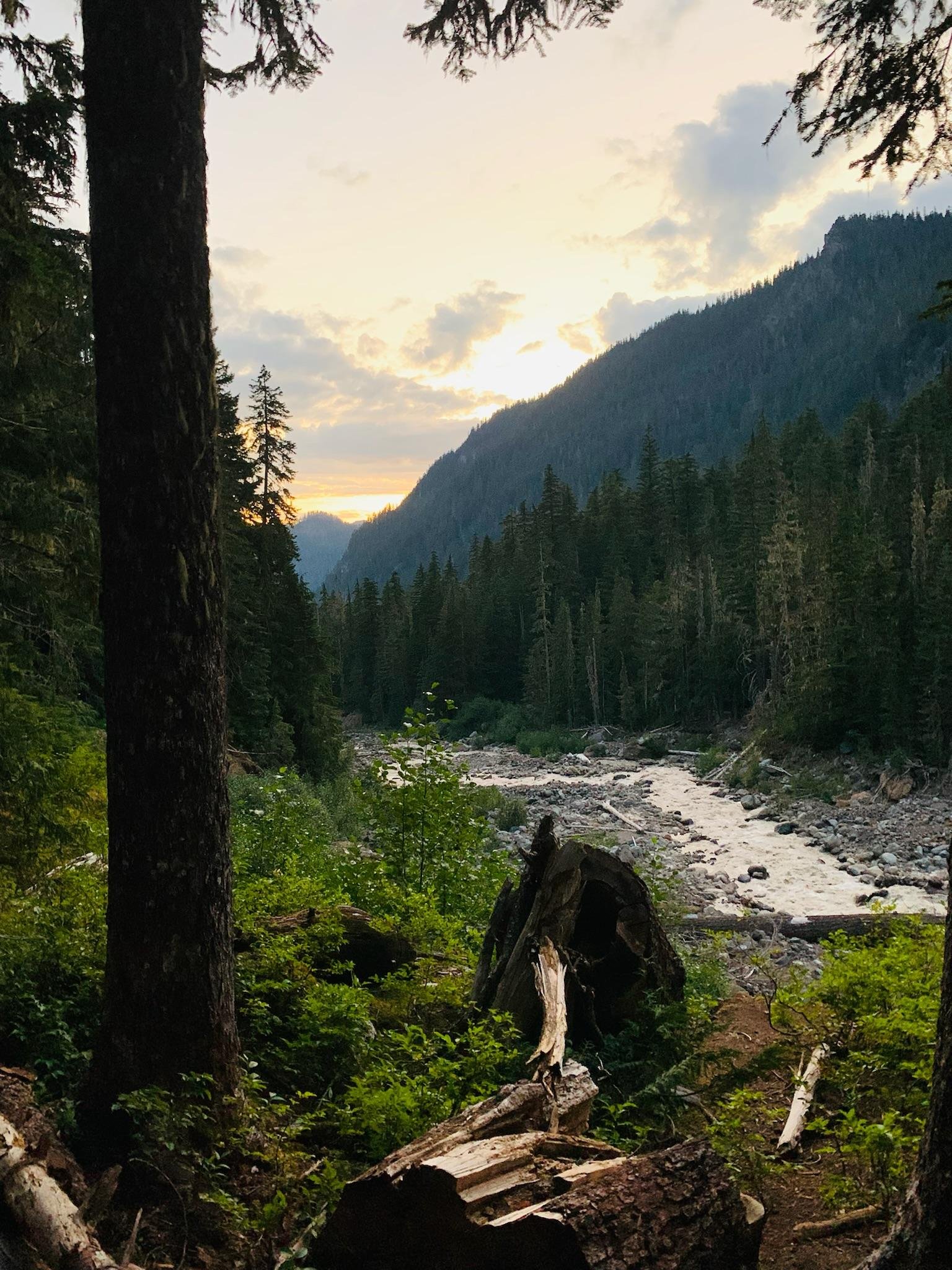
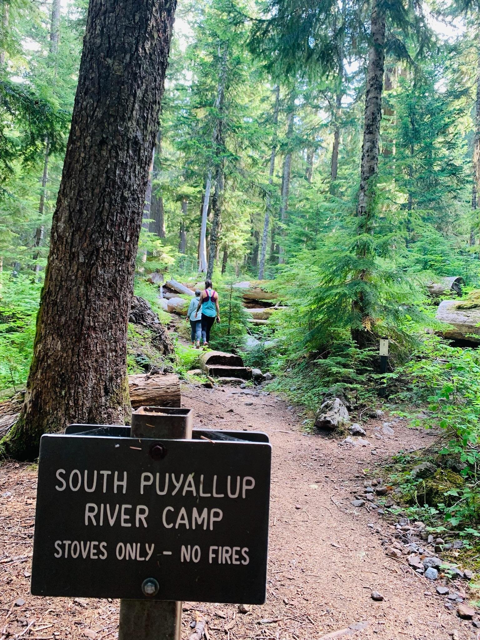
8/24/22 | Day One | South Puyallup River Camp | 12.8 miles from Longmire
The first day was really difficult but awesome. We saw so many marmots, filtered water for the first time, and used a privy for the first time. We also learned how to pronounce Puyallup. Rather than “Poo-Yall-Up” or “Pull-Ups” or “Pull-Yall-Up”, a local helped us out and told us to think about a pew, a church pew… Pew-All-Up. Thank you, friend!
From our campsite, we could hear the river flowing beneath us and I made sure to note “slept like a rock” in my trail journal. At camp, we also met a gal named Catherine. She was such a delightful soul and shared her story with us while sitting on a perfectly cut tree stump. This was also our first night using the bear pole system. After wrangling Catherine’s bear bag up the pole, we ventured back to our bags, hoping it would be easier to hang ours. It was not any easier – in fact, I wish someone caught a video of the three of us waving the bag hanging pole in the air, while we barked orders “left… right… so close… I can’t see…” and the thuds of bags hitting the earth in defeat. Eventually we would become pros.

We also learned there was columnar lava in the direction of the privy. Of course we had to walk back over to check it out in the morning before heading out.
One of the best aspects of the trip was the frequent reminders from earth, that people before us, thought far enough ahead to preserve this wild place for future generations.
8/25/22 | Day Two | North Puyallup River Camp | 6.7 miles

This was probably my favorite day! We found the magical St. Andrews Lake at the top of our climb for the day. We stopped to have lunch here and dipped our toes in the water. It felt good to dry our shirts and socks on a rock by the lake before continuing downhill to camp.
By the time we made it to what seemed like the North Puyallup Campsite, we were exhausted and hungry. We decided to set up camp with the most amazing view. We couldn’t believe we beat other campers to this spot. It seemed like a dream. After setting up the tent, we changed into camp clothes and went looking for a water source, the privy and bear pole. We came across two others setting up camp. They pointed us in the direction of the restroom and bear pole then asked if we were camping across the wall. We were confused by this and told them we snagged a spot over by the brick wall but not on the other side of it. They let us know we were actually set up at the viewpoint, where people can look out to the water below.
Oops! They assured us they thought the signage was slightly confusing as well and that it was easier to spot where the trail came and went, by going through the section from the opposite direction. We decided to leave our camp where it was, as it was obvious other people had slept there previously. No vegetation was hurt in this due to the overlook being dirt and gravel. We also didn’t end up seeing anyone else while there. Though it was a Thursday and probably sees more visitors on the weekend.
Remember how I said we would become pros with the bear poles? Well, it didn’t happen on day two. While trying to hang my bear bag by headlamp and tired arms, it somehow came unclipped. This resulted in the pole launching down into my thigh and my bear bag falling. In a panic I quickly pulled down my pants to see what the damage looked like. A massive circular bruise was already forming and skin was peeled in the shape of the bear pole. Luckily, the rusted, open-ended pole did not go through my leg. Instead I had a nasty bruise the rest of the journey and really took the time to ensure both legs were out of the way of the bear pole every night after.
8/26/22 | Day Three | Mowich Lake Camp | 15.1 miles
The first line in my trail journal says “GREAT UNTIL MILE 12”. This was also the first day we started to write down our times to complete sections. Day three was about 8 hours. There was a pretty big climb at the end and it felt like it would never end. In the last few miles, I remember meeting so many cool people along the way. We had great weather, no bugs, and were picking up our first food cache. One of our pals hopped off trail for a few days but made sure to meet us where she could. This meant beer and gummy candy was delivered to our awesome campsite! At Mowich Lake, there are bathrooms (the kind with doors) and a lot of people, some day hikers and others hiking the entire trail. I wrote about the fog being thick up at Mowich. It was cold. I was happy. There was a weird level of peace up there. Even with people around – chatting friends, boiling stoves, and clanks of cups – it was quiet.
8/27/22 | Day Four | Ipsut Creek Camp | 5.5 miles
This was our easy downhill day. It took about 2.5 hours. Even though it was truly downhill the entire time, it still felt hard on our sore bodies. With achy feet and backs from the weight of our packs, we found a way to shuffle into some resemblance of a run. We wanted to get to camp quickly to have extra time to relax and dry out our tent from the fog/rain at Mowich and it paid off. We sat in the nook of a tree on a pile of moss, ate our lunch, and walked around to see the other campsites.
8/28/2022 | Day Five | Granite Creek Camp | 12.9 miles
Day five was incredibly hard because that’s when I started to feel aches and pains. This took about 8 hours. After 12 miles of a lot of uphill, we came across one of the rangers we met on our food cache day. I kept saying I needed a beacon of hope to show we were getting close. We talked to the ranger about his week and he shared that he had to escort people off the trail because they were camping without permits. We had heard of the possibility of people being asked to leave the trail without a permit but now we were learning from the ranger how it actually happens. (Note: Always check what permits are required for backcountry adventures!
Luckily, we had our permit attached to my bag and then we transferred it to the tent as soon as we set up.) We continued to ask the ranger about how far we had until the Granite Creek Camp. He told us we were less than a mile away uphill but there was a lovely creek awaiting us to soak our feet in. As soon as we got to the camp, we washed some of our clothes in the ice cold creek. I found an extra rope from our tent and fastened it between a tree and log to make a clothesline.
8/29/2022 | Day Six | White River Backpacker Camp | 8 miles

We took advantage of baby climbs and a big downhill for a 3 hour and 20 minute trip. We saw 2 bears today. One was far away and the other was much closer. It was truly amazing, especially with how many people were out today. Once we got off the trail and into the front country White River camp, we heard backup beeping noises, found a water fountain, and a parking lot with real bathrooms. Luxury! After filling up our water bottles the easy way, we walked through the parking lot and met a guy named Chris, his wife Janet, and their friend Bob. I jokingly offered them $20 for one of their Coors Light. Chris told us to come over to their truck and gave us 2 beers, free of charge! It was like hitting the lottery. We laughed and thanked them. We learned they are locals and did a section of the trail today. They offered us their last apple slice to share. We talked about the book Wild by Cheryl Strayed and how their granddaughter recently hiked the PCT and told them it was the best thing she’d ever done. After our three new friends finished their beers, they wished us well and handed us 2 pamplemousse La Croixs. We are still so thankful for their kindness and laughs.
This was also our day to pick up another food cache! While grabbing our bucket, we met Sydney and Ben who were scoping out the food cache location prior to starting their hike. They asked for trail secrets and we talked about water being abundant and the amount of gratitude we have for being able to do this. After parting ways, we enjoyed our La Croixs in the sun with our lunch. Even though the black flies were relentless, we enjoyed laying in the sun near camp.
8/30/2022 | Day Seven | Nickel Creek Camp | 18 miles
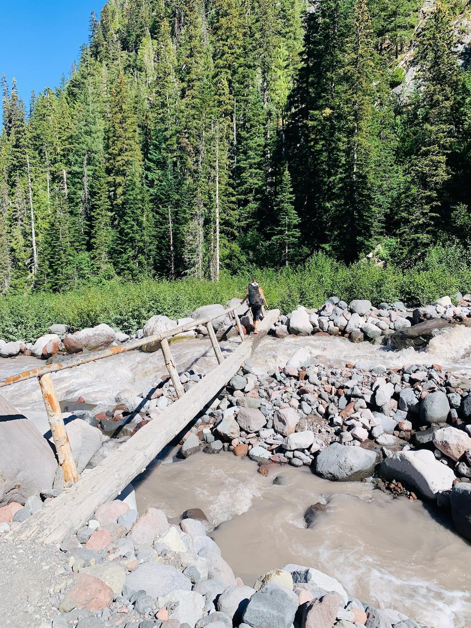
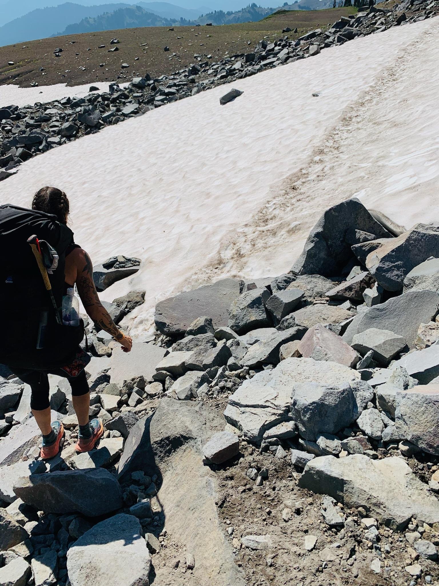
This was our biggest day! 18 miles across the eastern side of the mountain was so hard but so worth it. We saw so many wildflowers and crazy views. We walked through several snowy patches, traversed a rapidly flowing river of snow melt, climbed up to peaks and down into valleys. At 11.5 miles in, we stopped in the shade at Indian Bar. We were so sunburnt from the exposure and I was feeling really nauseous. We ate snacks and tried to cool down with a water fillup. After our short break, we had the hardest section – up, down and back up one more time. At some point, I lost track of one of my friends and started to think the worst. Either I was lost, she was hauling, or something terrible happened. I called out ahead and she hollered back that she was ahead, resting in the shade. Phew! We continued on at our own paces and I wouldn’t see my friend again until we had about a mile left. I was feeling pretty down around mile 15 and decided to check my phone for service. I had it and immediately called my husband. He talked me down a notch after panicking about being tired, alone, and delirious – until I lost service and the call dropped. I decided to speak to the woods or bigfoot or whatever was out there and asked for a sign that I was getting close. Right down the trail in front of me was a sign and I let out a joyful cheer. Then, I noticed the man sitting on the ground with his belongings strewn about. He greeted me and said my friend was about 5 minutes ahead of me and she asked him to let me know. I thanked him and asked if he needed anything before I continued on. Turns out, he was just taking a lunch break with his fully unloaded pack. I decided to run downhill as fast as my legs would let me. It was the longest 1.9 miles of my life but I finally caught my friend and made it to camp.
8/31/2022 | Day Eight | Paradise River Camp | 9.5 miles

Almost there! This day felt long and the climbs felt longer. We had about 4.5 miles of climbing to do on tired legs after the previous day's 18 miler. This took us 5.5 hours. We didn’t have a true time set for wanting to reach Paradise. The only goal was to meet up at Reflection Lake for a quick lunch break with a view. We got to the lake, (only to find out later that it was Louise Lake – Reflection was further along the trail), sat down by the water for lunch, where a bird swooped down from a tree trying to take my vegan jerky. It grabbed my thumb with its talons as it missed the jerky then proceeded to watch from a tree above until we were done. Along this section of trail we found so many huckleberries. I ate approximately 700 of them and my friend AJ dubbed me “Huckleberry” as my trail name. I named her “Seabiscuit” on the first day – this was her first backpacking trip, she has a long stride, and is a super fast hiker! After lunch we had 1.9 miles until camp, mostly downhill. We finally arrived at the camp sign which points you back up another hill and looks like the trail or camp is new. Lots of broken roots, downed trees, and tossed dirt. This was our least favorite campsite. We also had a number of bear scares (bigfoot, is that you?) here. We heard things dropping from trees around us for hours. We saw low branches and bushes move. We saw shadows higher up above the camp. We set “trip lines” and arranged our trekking poles around the tent. We slept with a knife between us and a whistle around my neck. We never felt scared on the trip until this night. We also always saw other people at the campsites until this site.
9/1/2022 | Day Nine | Finish at Longmire | 3.9 miles

We woke up after a stressful night at Paradise and wanted to soak up our last morning in the woods. We had coffee and talked about how we weren’t ready to go back to reality. I never did end up writing in my trail journal for this day. I think I wanted to savor every part of it for me – internally. What I can say is, we met so many amazing people on our hike out! I also made sure to plug in my headphones to listen to the soundtrack of the youtube video that inspired this trip. It was glorious! Once we made it back to Longmire, I picked up my stamp for my National Parks Passport and then we headed over to the gift shop to grab a celebratory beer!
Maps and Safety
In terms of maps and safety, we packed a National Geographic waterproof map of the Wonderland Trail and borrowed a Garmin inReach Mini (thank you, Emma!). We used the FarOut App and paid $19.99 for the Wonderland Trail download. This provided us with images of each site, distances between sites, water sources and quality, recent updates from other trail users, and elevation profile. We found this to be useful mainly for the information regarding water sources.
Gear
One of the things asked most is what gear to bring. I wanted to provide a list of the items I used but this is certainly not an all inclusive list.
Pack
Osprey Women’s Kyte 46L – This felt like a great size for me. With everything in it, I didn’t have much room to add anything extra. I definitely had to be methodical while packing and throughout the trip, I found ways to pack it better.
Patagonia Ultralight Black Hole Mini Hip Pack – I purchased this the day before our hike and was so happy to have it. While my pack has hip pockets, this allowed me to have a larger front pocket for my phone, headphones, and easy access snacks.
Water Filtration and Stove
Sawyer Squeeze, Sawyer 16oz & 32oz bags – This was our first time filtering water and the Sawyer Squeeze did not disappoint. We also brought SmartWater bottles to filter clean water from the Sawyer pouches, through the Sawyer Squeeze and into SmartWater bottles. We maintained a minimum of 16oz of water on us at all times just in case we came upon a dry section of trail or a fellow hiker in need.
Jetboil Stove – I ordered this specifically for the trip and I was happy I did. Like it’s name suggests, it boils water very quickly and allowed me to minimize how much fuel I needed. Speaking of fuel, we each brought an 8 ounce can of fuel and stowed an extra 4 ounce can in our food cache, just in case. We didn’t need it and were able to donate it to the hungry hiker bin. These bins are for people who need more fuel or food. So awesome!
Sleep System
Thermarest ProLite sleeping pad – Comfortable and lightweight. Only my second time using it and it worked well for this trip and the conditions.
Sea to Summit Thermolite Reactor Liner – I borrowed this from a friend of a friend. It added an extra layer of comfort and warmth without being too heavy.
Sea to Summit Ultralight Flame Sleeping Bag 38 degrees - I also borrowed this from a friend of a friend. These items are on my list to purchase in the future. My current sleeping bag is a Kelty 20 degree but it seemed too heavy for this trip.
Peregrine Aerie Ultralight Pillow – I purchased this specifically for the trip and was overall very happy with it.
Dry Bags
Wise Owl Dry Bag 10L – I ordered this online as a backup and I am glad I did. I purchased a mainstream name brand dry bag but it busted open the morning of my trip while packing it. Meanwhile, my Wise Owl endured the entire trip and I used it as my food bag to hang on the bear poles at camp.
Smelly Proof Bags – I don’t love the idea of giant zippered plastic bags but the smell proof, reusable version worked wonders on this trip. I used several to organize and “smell proof” everything in my bag. All but one survived.
Electronics
Garmin Forerunner 230 – I couldn’t charge it a couple days due to a charging block failing but this watch is 7 years old and still thriving.
Garmin InReach Mini – We borrowed this from a friend and were happy to have it! Not only did we have the extra security of calling for help if needed, but we could send short texts to friends and family to let them know we were alive.
Solar charging block – Completely useless other than the first night. Even with being on exposed ridges and strategically placing the block in the sun at lunch/camp, it wouldn’t charge.
Mophie Powerstation – I had a smaller and a larger version of these. Once we were able to pick them up at the White River Campground, we were able to charge my watch and the Garmin InReach again. These were heavier than the solar charging block but worth it since they actually worked!
Additional Gear
Trekking poles, camp spoon and cup, sunscreen, bug spray,
My pack weight before water was 27 pounds and included 3 days of food plus, gear and clothing.
Clothing and Shoes
Patagonia Capilene short sleeve and long sleeve tops Tracksmith Allston Shorts
Rabbit 4” Leggy Shorts
Patagonia Women’s Barely Everyday Bra Falke RU Trail Women Running Socks
Darn Tough Women's Micro Crew Ultra-Lightweight Running Sock
Hoka Speedgoat 5
Teva Original Universal Sandals
Buff Merino Beanie
Richardson FKT Jus’ Running Hat
Nutrition & Hydration
Electrolytes
Salt Stick Fast Chews – Mango – these were excellent for electrolytes in the morning and evening. I fell into a routine of chewing two everyday before the start of our hike and two every night before bed.
Nuun Hydration – Watermelon Sport – a good option to mix into my water in the evening for something more flavorful.
Food and Beverage
Everyone’s nutritional needs are different and being vegan, my nutrition looked a little different than my friends. My food included things like:
Justin’s peanut butter packets
Death Wish Instant Coffee
Coconut powder as creamer
Vegan jerky
Made Good Rice Crispy Squares
GoMacro kid bars
Farm to Summit - vegan backpacking meals
Nomad Nutrition - vegan backpacking meals
Maple cinnamon mixed nuts
Roasted chickpeas
Plant based tuna
Tortillas
Lots of Yellowbird Serrano hot sauce
A Dozen Cousins - Refried pinto beans
Plant based chocolate chip cookies
Oatmeal - The GFB Nut & Seed Pop Up Bowls
Lavender chamomile hot tea
Water sources

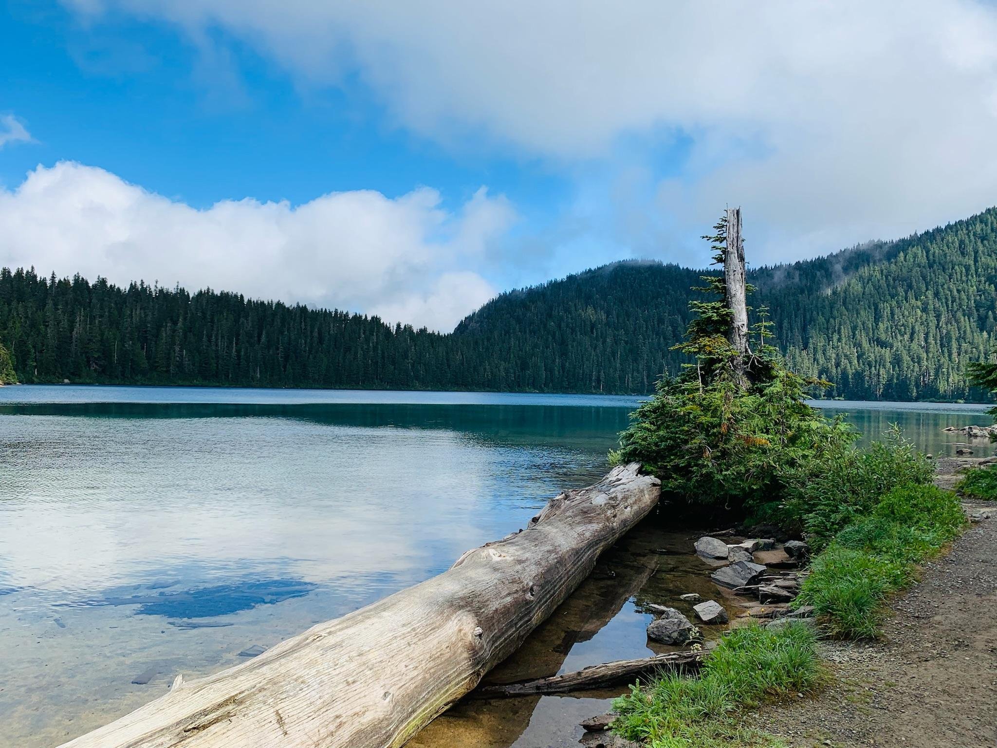
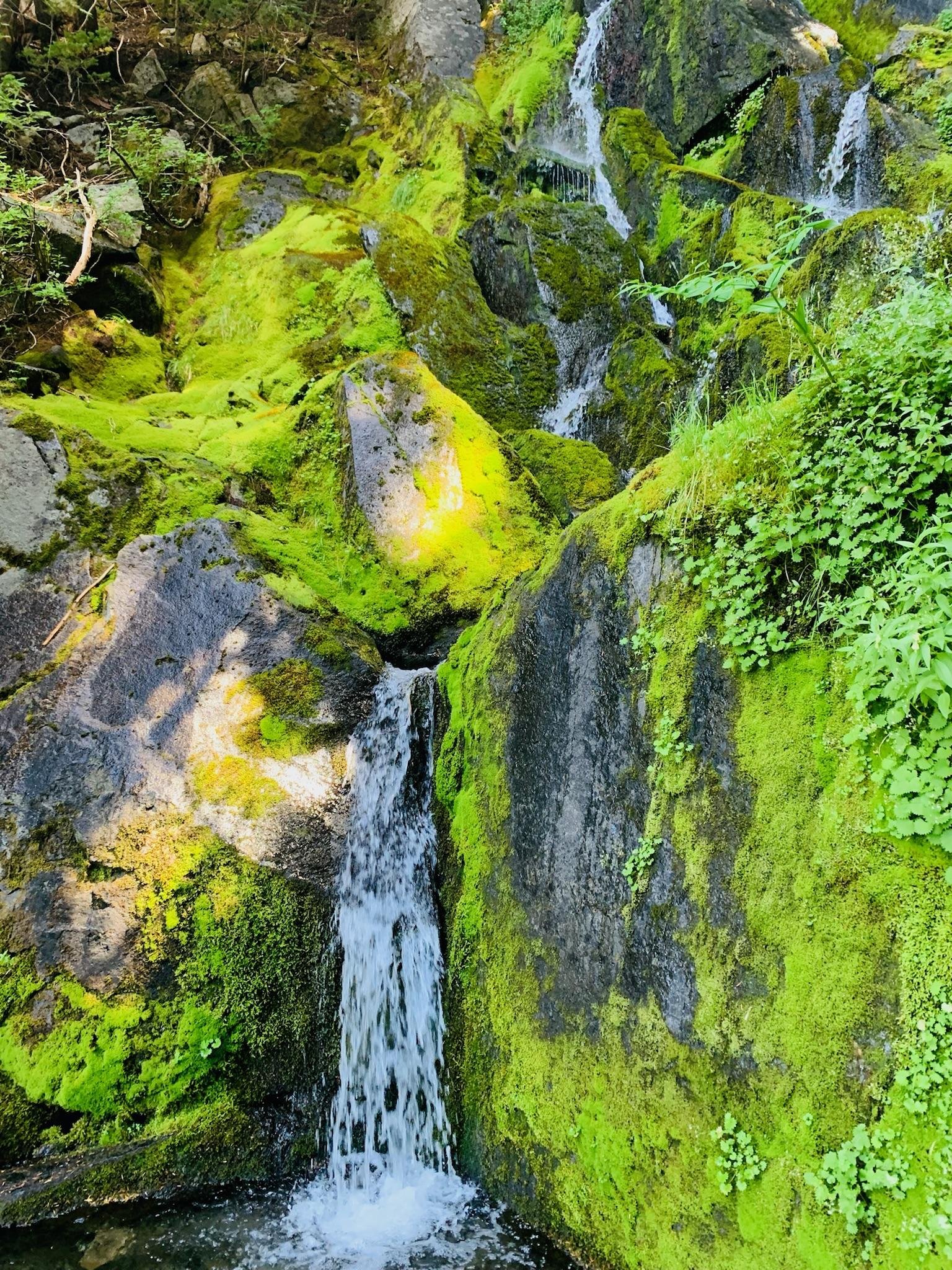
Two of us had the Sawyer Squeeze which worked perfectly. One of us had Sawyer Squeeze Mini which was not as efficient since it has a slower flow rate as a smaller filter. Water along the Wonderland Trail is abundant. With so many rivers, lakes, streams, and waterfalls, it was easy for us to find clear, running water. There is nothing quite like (or as fresh as) balancing on a rock, in the middle of nowhere, to collect ice cold water pouring over perfectly placed, bright green moss.
Bears, Bugs, Bathrooms, and Berries
Does a bear [insert another word for “using the bathroom”] in the woods? The answer is yes – and so does everyone else. While on our hike we were able to utilize the wilderness toilets – a bucket-looking system with a wooden platform and double lids to keep the critters out. I read about how you can leave trail signs to other hikers by laying your trekking poles in an “X” across the toilet trail to let others know it's occupied. I like to think this helped keep people from walking up on me while using the bathroom.
Other important things to note are the bears, bugs, and berries! We spotted two bears in one day. One was far away in the distance and a couple miles later, we found one on the trail in front of us. Both times we stopped and watched in awe of how beautiful they were. Neither seemed to notice us but if they did, they didn’t care. We gave them space and allowed them to do their thing, then continued on our way. Admittedly, it was a little scary with the second bear since it was closer but we loved seeing it.
Bugs were not as bad as I thought they would be. We were warned about black flies being out and they certainly were but they only appeared in sections of the trail. The worst spot was when we passed through Devil’s Dream Camp and then encountered moderate amounts of them sporadically.
At some point we realized we were in a huge berry patch of trail. We figured they were safe to snack on because they looked similar to blueberries (probably shouldn’t assume). Turns out, they were huckleberries! We couldn’t stop eating them and rejoiced anytime fellow hikers told us we were coming up on a berry patch.
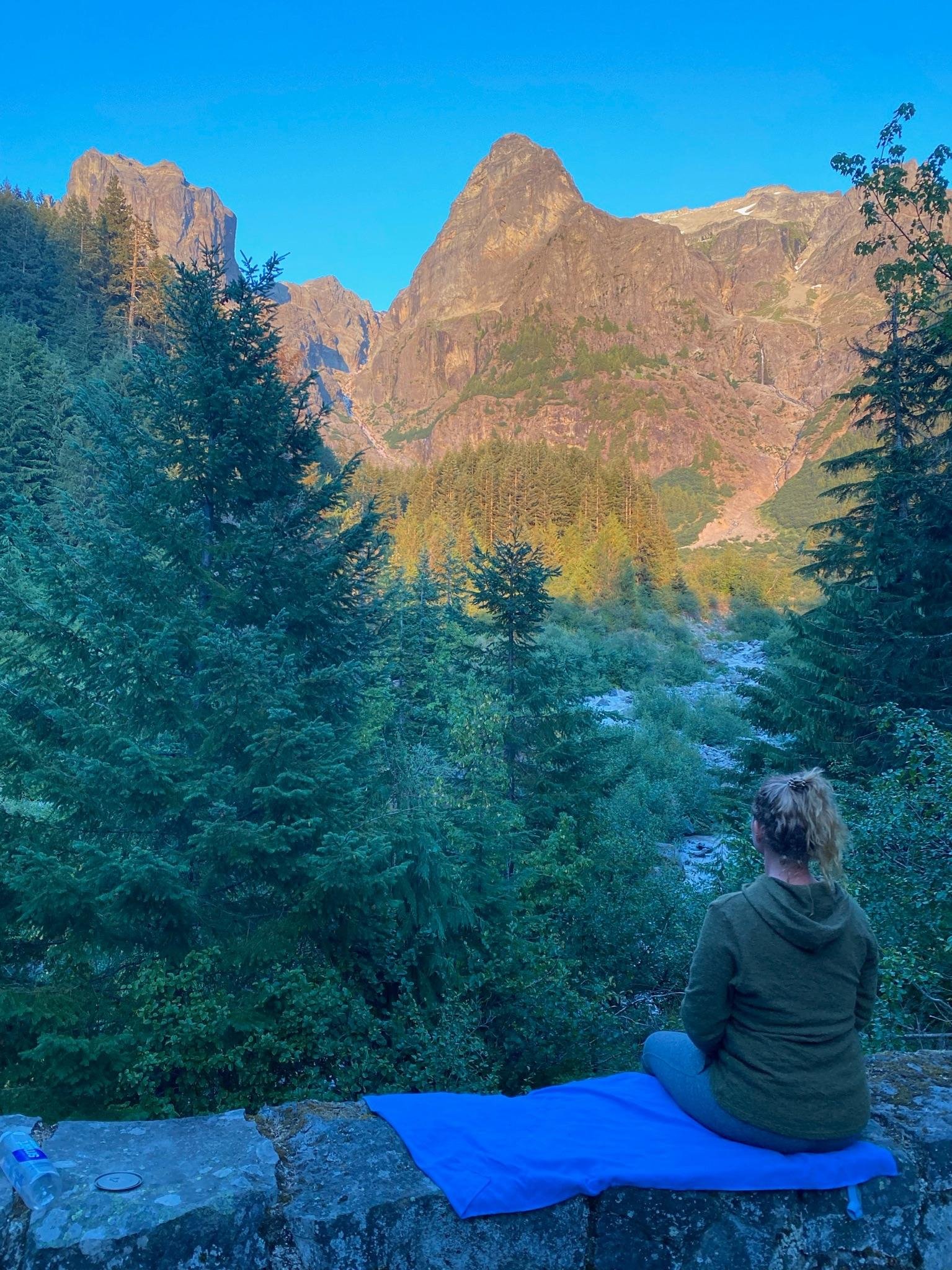
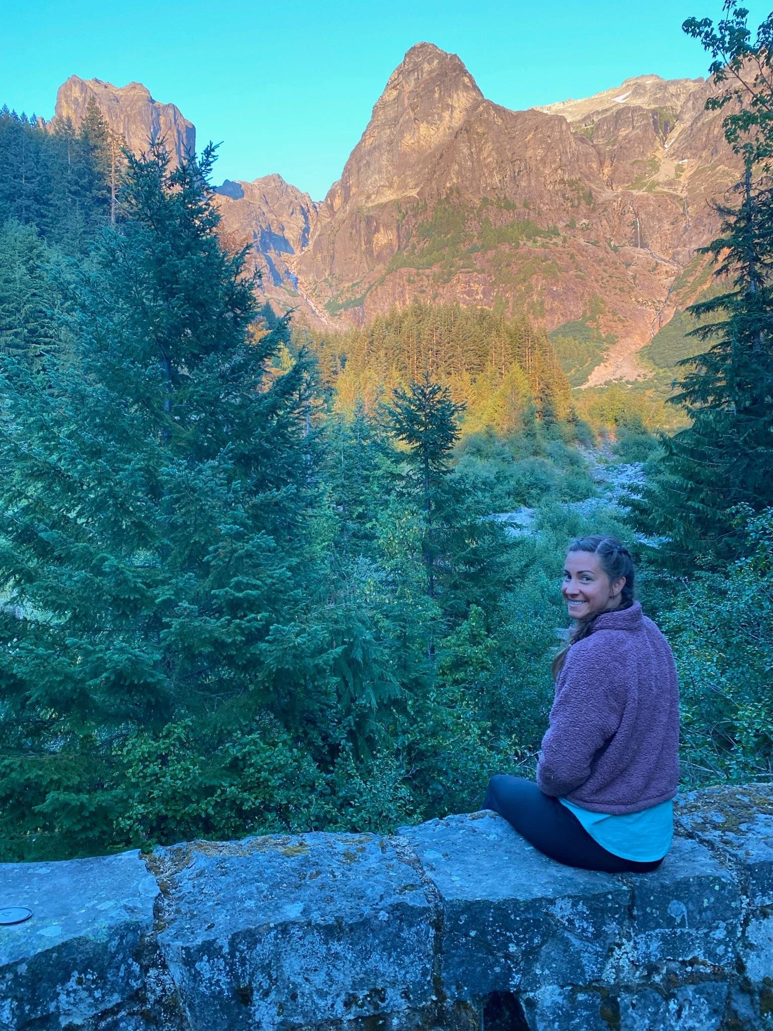
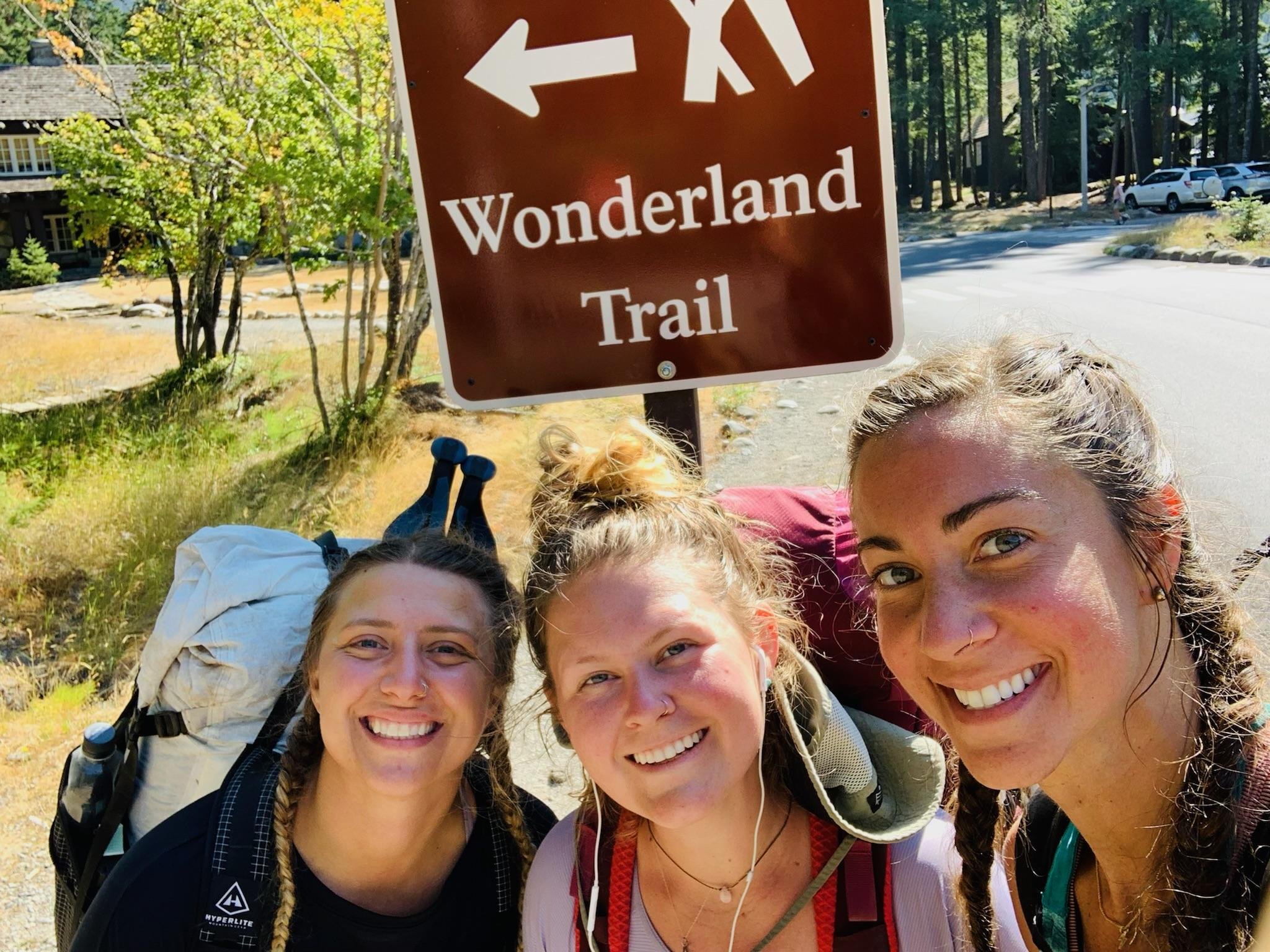
Below: Before the hike photo on the left, and after the hike photo on the right
Thanks for reading!
- Savanna “Huckleberry” Waites
Online Source Material
https://www.nps.gov/mora/planyourvisit/the-wonderland-trail.htm https://visitrainier.com/wonderland-trail-overview/ https://fastestknowntime.com/route/wonderland-trail-wa https://www.wonderlandguides.com/hikes/wonderland-trail/itinerary-planner
Books
“Hiking the Wonderland Trail: The Complete Guide to Mount Rainier's Premier Trail” by Tami Asars
“Plan & Go | Wonderland Trail” by Alison Newberry and Matt Sparapani